|
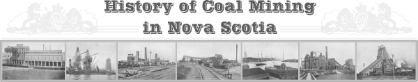
The Louis Frost Notes 1685 to 1962
Description of Pictou Coal Field
The Pictou Coal Field described herein, has been worked over
a period of more than one hundred and fifty years and is at this
date largely depleted, although certain sections of the field still
contain pockets of mineable coal. An appreciable proportion of this
coal is not economically recoverable.
The coal field lies about 9 miles inland from the shore of
Northumberland Strait and just beyond the head of the tidal water
of the East River, at which point the Town of Stellarton is built.
The area occupied by the productive coal measures which are
of carboniferous age, is comparatively small as the coal belt extends,
roughly, only ten miles in an East and West direction, with a minimum
width of three miles. The Town of New Glasgow is situated on the
northern boundary of the coal field and lies approximately half-way
between its eastern and western extremities.
The coal field is relatively small in area, its economic
strength being derived from the number and the thickness of the seams;
but this was to some extent offset by its complicated geologic structures and by the numerous faults, many of considerable extent, which
cross the field in various directions.
The coal field has been carefully mapped out, but owing to the
sudden changes that occur in the thickness and quality of the seams
within very short distances, some drilling and prospecting work is
still required to determine and define the remaining sections of
coal that are available for economic development. In this respect it
should be understood that evidence obtained of the deterioration of a
seam in thickness and quality does not apply to other seams which
may be lying above or below it.
So far, present knowledge of the field would indicate that
the coal measures may be divided into three productive horizons.
The uppermost horizon contained five workable seams and has
been developed at Thorburn on the Eastern extremity of the coal field.
The measures in this series gradually rise to the west and all seams
crop out at the surface in the form of an irregularly shaped basin
before reaching New Glasgow. Below this horizon are masses of shale,
some of which are oil bearing and finally, at an estimated distance
of 2,000 feet below the lowest known seam of the "Thorburn series",
the Foord Seam is found.
In the Thorburn Series, the MacBean Seam is now being worked
by the Acadia Coal Company and Captain Seam by the Greenwood Coal
Company, one of the independent companies in this area. The Foord
Seam, which in part of the field contained forty feet of marketable
coal, marks the beginning of the middle horizon or the Stellarton
Series. In this series five seams have been worked and another six
seams have been proved by boring below this horizon, but have not
been worked and are unlikely to be economically recoverable.
From the lowest known seam of the Stellarton Series there is
an estimated distance of 1,000 feet of unknown strata to the "Acadia'
or Main seam, the topmost seam of the lowest horizon, the Westville
Series. In this division there are four seams, but to date only
two of these have proved to be of commercial importance.
At present there are three companies operating in the Pictou
field and quite recently application for a sub-lease has been made
by a fourth, the Linacy Coal Company. The companies long established
in the area are the Acadia Coal Company Limited, the Intercolonial
Coal Company Limited and the Greenwood Coal Company Limited.
The Intercolonial Coal Company Limited holds an area of eight
and one-quarter square miles of coal lease at Westville and the
Greenwood Coal Company Limited operates on a small scale at Thorburn,
on coal leases covering 6.2 square miles but only part of this lease
covers the known productive coal measures. For some years past
this Company has been operating on a sub-lease granted them by the
Acadia Coal Company Limited, the major lessee in the Pictou field.
The Acadia Coal Company has a lease covering 19 square miles
which stretches from Westville on the West to Thorburn on the Eastern
flank of the field. Part of this area does not contain any seams
of commercial value and in other sections the coal seams have been
largely worked out, except for the outlying sections along the outcrop of the seams in the Westville and Thorburn areas. In these
two areas are the only known workable reserves remaining to the
Company, of which only those in the Thorburn area are economically
recoverable.
As already indicated, the Acadia Coal Company holds under lease
from the Province of Nova Scotia 19.0 square miles of coal bearing
land in Pictou County. This lease may be divided up as indicated
in the following table, where the area has been divided up into the
productive and non-productive section of the field, the former containing the area worked over and the balance containing such seams
worked over and the balance containing such seams as may be workable
but not economically recoverable.
ACADIA COAL COMPANY
Coal Leases

			Non-			Area
			Productive  Productive  Worked Over
Area	    Sq. Miles   Sq. Miles   Sq. Miles   Sq. Miles    Balance

Thorburn	6.8	    2.6		4.2	    2.0	       2.2
Stellarton	9.7	    3.5		6.2	    2.4	       3.8
Westville	2.5	    1.0		1.5	    0.4	       1.1


T o t a l      19.0	    7.1	       11.9	    4.8	       7.1
A plan showing the lease holding of Acadia Coal Company
is attached.
|